To get to the Barcelona Mobile World Congress, you can choose between the L8 and L9 metro lines.
- From Barcelona airport, you only have to follow the line 9 from your arrival terminal to the Fira or Europa Fira stops which bring you directly to the foot of the event ;
- From Plaça Espanya, take the line 8 to Europa Fira metro station ;
- If you come by train to Sants station, you can choose between take the line 5 (blue) to Collblanc metro stop and get the line 9 to Fira station, or the line 3 (green) to Espanya and reach the Mobile World Congress with the line 8 by exiting at Europa Fira metro stop.

Barcelona metro map 2026
Barcelona metro map with tourist attractions

Barcelona metro map (updated in January 2026) for ipad, or tablet ; let us guide you along every step in your route.
Click, display, zoom, and drag the Barcelona metro map from one side to the other of the Catalan capital to locate your station and find out where, when, and how to change lines and modes of transport between connections to access tourist sites, squares, and monuments to visit.Multi passes
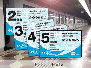
Enjoy transport + tourist attractions
Discover how to combine unlimited access to Barcelona's public transportation and access to many of Barcelona's must-see tourist attractions.
Barcelona metro map with tourist attractions JPG
Barcelona metro map with tourist attractions pdf
Barcelona metro lines
Barcelona metro map line by line
Barcelona metro map line 1
Barcelona's metro line 1 runs from Hospitalet de Bellvitge to Fondo with a total of 30 stations, 15 of which have links to other lines. The line 1 of the Barcelona metro network (the red line) provides access to many of Barcelona's must-see attractions such as Las Ramblas, the Montjuic district and its Olympic park, as well as the Ciutadella park, the Triumphal Arch or the various tourist sites located around Plaça Catalunya.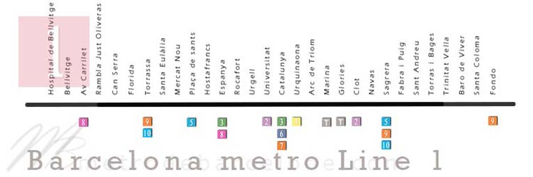
Barcelona metro map line 2
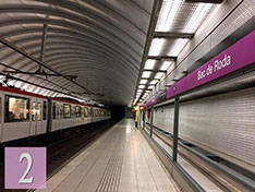
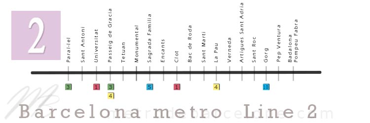
Line 2 of the Barcelona metro runs from Paral-lel to Badalona, with a total of 18 stations, including 8 links to other lines.The line 2 provides access to many of Barcelona's highlights such as the Barcelona Arena (Monumental), Passeig de Gracia, the Montjuic funicular that leads halfway up its park, and the Sagrada Familia.
Barcelona metro map line 3
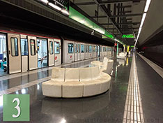
26 stops including 16 connections from Zona Universitaria to Trinitat Nova. The Barcelona metro line 3 guides you to the most beautiful squares and parks of Barcelona such as the Guell Park or the Horta Labyrinth, Plaça Catalunya, Plaça Espanya as well as the Palau Reial. The line 3 (green line) also runs along the Ramblas from Drassanes station to the Catalunya stop, providing easy access to the port and the Gothic Quarter.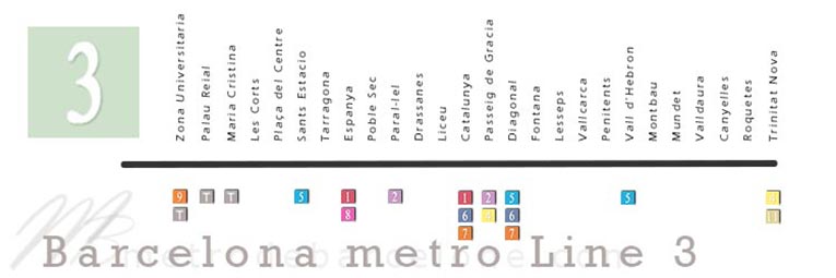
Barcelona metro map line 4
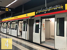
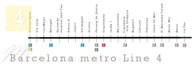
The Barcelona metro line 4 (yellow line) runs through 22 stations, 8 of which have connections, along the city's beaches from Barceloneta to the Forum, passing through the Olympic port, and also through the Gothic Quarter.The line 4 serves the accesses to great monuments and sites of Barcelona such as the Cathedral of Santa Cruz and Santa Eulalia, the Casa Batllo, the aquarium or the zoological park of Barcelona.
Barcelona metro map line 5
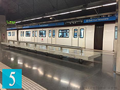
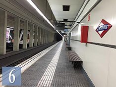
From Cornella Centre station to Vall d'Hebron, Barcelona metro line 5 (blue line) has 27 stations and 13 connections, including one with line 9 which leads to the T1 and T2 terminals of the airport. The line 5 also leads to the foot of the Sagrada Familia, the Paseo de Gracia, and the Avenida Diagonal. This is the line that leaves you at the heart of the main Sants train station, and will drop you off at the FC Barcelona stadium.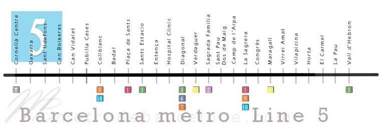
Barcelona metro map line 6
From Plaça de Catalunya to Reina Elisenda, the line 6 consists of 9 stations which, among the most touristic places and attractions of Barcelona, give access to Plaça Catalunya and all that connects to it such as the Ramblas, Avenida del Portal de l'Àngel, the Gothic Quarter, Passeig de Gracia or Rambla Catalunya. The Barcelona metro line 6 also leads to the very famous district of Gracià.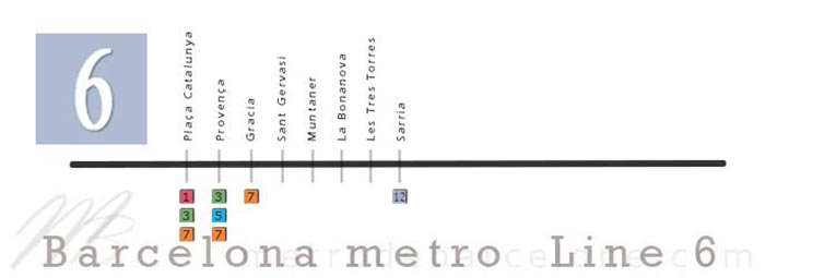
Barcelona metro map line 7
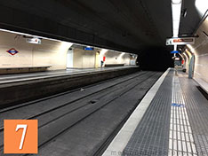
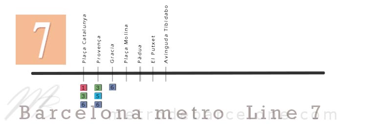
The Barcelona metro line 7, which connects Plaça Catalunya and its attractions with Avenida del Tibidabo, also provides easy access to some of Barcelona's must-see sites, such as Plaça Catalunya and the Ramblas.The Barcelona line 7 brings you close to the funicular that climbs to the foot of Tibidabo, Barcelona's theme park.
Barcelona metro map line 8
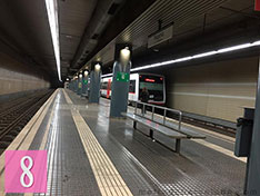
From Plaça Espanya station to the Moli Nou - Ciutat Cooperativa stop, the Barcelona metro line 8 provides access, among Barcelona's must-sees, to the Plaza Espanya and its former bullring converted into a shopping centre, the Montjuic district, the Espanyole stadium and the magnificent Colonia Güell. Like lines 6 and 7, line 8 is part of the FGC network.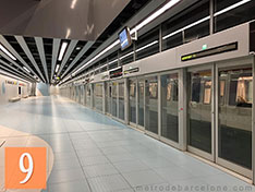
Barcelona metro map line 9
The Barcelona metro line 9, which runs from La Sagrera to Can Zam in the northern part and from Zona Universitaria to the airport T1 in the southern part, is the metro line that serves the T1 and T2 terminals of Barcelona airport. The line 9 also provides access to the Fira de l'Hospitalet de Llobregat and the Camp Nou stadium via the Collblanc station. At the end of the evolution, line 9 will have a total of 52 stations.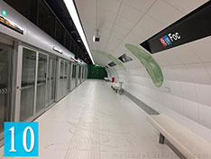
Barcelona metro map line 10
The Barcelona metro line 10, which runs from La Sagrera to Gorg in the northern part and from the ZAL / Riu Vell stop to Collblanc in the southern part, shares part of its route with the line 9.The line 10 has only 6 stops for the North line and 11 stops for the South line, which facilitates access to the FC Barcelona stadium.
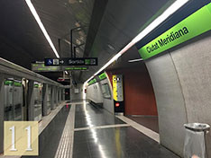
Barcelona metro map line 11
Barcelona metro line 11 runs from Trinitat Nova station to the Can Cuiàs stop. With connections to lines 3 and 4, line 11 has only 5 stops.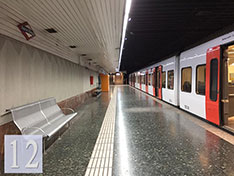
Barcelona metro map line 12
From Sarrià station to Reina Elisenda station, line 12 of the Barcelona metro has only 2 stops.Metro stations list

-
Hospital De Bellvitge
Bellvitge
Av Carrilet
Rbla Just Oliveras
Can Serra
Florida
Torrassa
Santa Eulàlia
Mercat Nou
Plaça de sants
Hostafrancs
Espanya
Rocafort
Urgell
Universitat
Catalunya
Urquinaona
Arc de Triomf
Marina
Glories
Clot
Navas
Sagrera
Fabra I Puig
Sant Andreu
Torras i Bages
Trinitat Vella
Baro de Viver
Santa Coloma
Fondo

-
Paral-lel
Sant Antoni
Universitat
Passeig de Gràcia
Tetuan
Monumental
Sagrada Familia
Encants
Clot
Bac de Roda
Sant Marti
La Pau
Verneda
Artigues Sant Adrià
Sant Roc
Gorg
Pep Ventura
Badalona Pompeu Fabra

-
Zona Universitària
Palau Reial
Maria Cristina
Les Corts
Plaça del Centre
Sants Estacio
Tarragona
Espanya
Poble Sec
Paral-lel
Drassanes
Liceu
Catalunya
Passeig de Gracia
Diagonal
Fontana
Lesseps
Vallcarca
Penitents
Vall d' Hebron
Montbau
Mundet
Valldaura
Canyelles
Roquetes
Trinitat Nova

-
Trinitat Nova
Via Julia
LlucMajor
Maragall
Guinardo I Hospital Sant Pau
Alfons X
Joanic
Verdaguer
Girona
Passeig de Gracia
Urquinaona
Jaume 1
Barceloneta
Ciutadella Vila Olimpica
Bogatell
Llacuna
Poblenou
Selva de Mar
El Maresme / Forum
Besos Mar
Besos
La Pau

-
Plaça Espanya
Magoria La Campana
Ildefons Cerdà
Europa Fira
Gornal
Sant Josep
L'Hospitalet Av Carrilet
Almeda
Cornella Riera
Sant Boi
Moli Nou - Ciutat Cooperativa

-
Cornellà Centre
Gavarra
Sant Ildefons
Can Boixeres
Can Vidalet
Pubilla Cases
Ernest Lluch
Collblanc
Badal
Plaça de Sants
Sants Estacio
Entença
Hospital Clinic
Diagonal
Verdaguer
Sagrada Familia
Sant Pau Dos de Maig
Camp de L'arpa
Sagrera
Congrès
Maragall
Virrei Amat
Vilapicina
Horta
El Carmel
El Coll la Teixonera
Vall d'Hebron

-
Plaça Catalunya
Provença
Gracia
Plaça Molina
Pàdua
El Putxet
Avinguda Tibidabo

-
Sarrià
Reina Elisenda

-
Trinitat Nova
Casa de l'Aigua
Torre Baro / Vallbona
Ciutat Meridiana
Can Cuiàs

-
Aeroport T1
Aeroport T2
Mas Blau
Parc Nou
Cèntric
El Prat Estacio
Les Moreres
Mercabarna
Parc Logistic
Fira
Europa I Fira
Can Tries I Gornal
Torrassa
Collblanc
Zona Universitària
-
La Sagrera
Onze de Setembre
Bon Pastor
Can Peixauet
Santa Rosa
Fondo
Església Major
Singuerlin
Can Zam

-
Plaça Catalunya
Provença
Gracia
Sant Gervasi
Muntaner
La Bonanova
Les Tres Torres
Sarrià

-
Foc
Foneria
Ciutat de la Justicia
Provençana
Can Tries I Gornal
Torrassa
Collblanc
-
La Sagrera
Onze de Setembre
Bon Pastor
Llefià
La Salut
Gorg
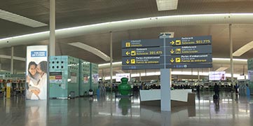
To get to the Barcelona airport terminals, follow the line 9 on our Barcelona metro map to the aeroport T1 or aeroport T2 metro stops.
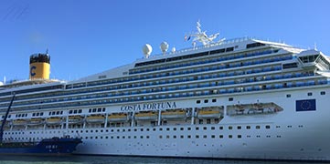
As soon as you arrive at one of the Barcelona cruise port docks, find out on our Barcelona metro map how to get the best out of your stopover.
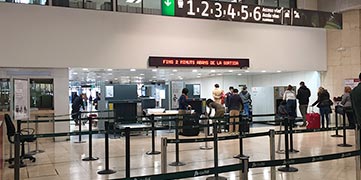
Locate the Barcelona's railway station (Sants estacio metro station) on our Barcelona metro map, and start planning your trips.
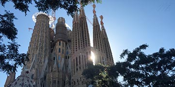
To get to the Sagrada Familia, there are 2 options ; Locate the Barcelona metro lines 2 and 5 and follow them to the stop which has the same name as Barcelona's most visited monument.
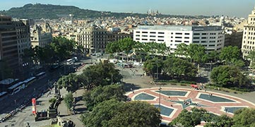
Barcelona's most famous square, Plaça Catalunya, can be reached by metro lines L1, L3, L6 and L7, at the Catalunya and Plaça Catalunya stops. The Urquinaona stations on lines L1 and L4, as well as the Universitat stops on lines L1 and L2, are just a short walk from Plaça Catalunya.
Which metro lines to get to
To get to the foot of the Sagrada Familia by metro, find the Sagrada Familia stop on lines L2 and L5 on our Barcelona metro map with monuments, and find out how to the most visited monument in Barcelona.
To get to FC Barcelona's Camp Nou stadium, take the L5, L9 or L10 lines to Collblanc metro station and find out on our metro map which route to follow to get to the Camp Nou stadium by metro.
To go to Montjuic by metro, choose between lines 1, 3, and 8 to Plaça Espanya ; or lines 2 and 3 to Paral-lel station to take the Montjuic funicular railway.
To get from Plaça Catalunya to Parc Guell by metro, simply take the line 3 (green line) from Plaça Catalunya towards Trinitat Nova to the Lesseps stop.
Then, if you want to visit other parks from Guell Park, continue on the same line (3) in the same direction and get off at the Mundet stop to visit Barcelona's Labyrinth Park.
By going backwards, still with the line 3, head back towards Zona Universitaria to the Espanya metro station to visit Montjuic Park ; and if you are looking for more parks, follow the line 3 to Palau Reial to discover the gardens of Pedralbes.
This is the Barcelona metro line 9 which serves both terminals of the airport del Prat ; It is connected to the L1, L3, L5, L8 and L10 lines, which provide access to many of Barcelona's tourist attractions as soon as you arrive at the airport, such as :
- The Camp Nou stadium (line 5) ;
- The Guell park (line 3 metro Lesseps) ;
- The Sagrada Familia (line 5 metro Sagrada Familia) ;
- Plaça Espanya (line 8 metro Plaça Espanya) ;
- La Rambla (line 3 metro Drassanes, Liceu and Catalunya) ;
- Plaça Catalunya (lines 1 and 3 metro Catalunya).
Barcelona's Ramblas run from the old port (Port Vell) to Plaça Catalunya ; to get there by metro, the green line (line 3) offers you three stops : the Drassanes station located at the foot of the port, the LIceu station, which takes you to the heart of the Ramblas and provides easy access to the Liceu theatre, the Plaça Reial or the Boqueria, as well as the Plaça Catalunya stop, where one end of Barcelona's busiest avenue is beginning.
Barcelona's beaches are served by the Barcelona metro line 4. (yellow line) ; quickly accessible via Barceloneta, Ciutadella Vila Olimpica or El Maresme Forum stations. To get to the Gothic Quarter from Barcelona's beaches, you just need to follow the line 4 from one of these stations to the Jaume 1 stop that will leave you just a few steps from the Cathedral Basilica of the Holy Cross and Saint Eulalia.
To get from Plaça Catalunya to Parc Guell by metro, simply take the line 3 (green) from Plaça Catalunya, towards Trinitat Nova to the Lesseps stop. If you then want to visit other parks from the Parc Guell, take the same line (L3) in the same direction and get off at the Mundet stop to visit Barcelona's Labyrinth park. By going backwards, still with the line 3, go back towards Zona Universitaria to Espanya metro station to visit the Montjuic park ; and if you're looking for more parks, follow the line 3 to Palau Reial to discover the Pedralbes gardens.
The Passeig de Gracia is a very long avenue stretching from the Gracia district to Plaça Catalunya, passing through many of the city's main avenues such as Provença, Mallorca, Valencia, Arago, Consell de Cents, Diputacio and Gran Via de Les Corts Catalanes.
The upper part of the avenue is accessible from the Diagonal metro station, which is served by the L3, L5, L6 and L7 lines, which provide easy access to the Casa Milà (la Pedrera), the Gracia district and Avenida Diagonal, among others.
The center of Passeig de Gracia can be reached by the station of the same name "Passeig de Gracia" which is connected by the L2, L3, and L4 metro lines as well as numerous train lines such as the R2 , R2S, R11 and R13 to R17.
The metro stop is located at the foot of two of Barcelona's must-see monuments, The Casa Batllo and the Casa Ametlle.
The lower part of Passeig de Gracia, which ends at the junction with the Ronda Sant Pere Avenue, enjoys all public transport links to Plaça Catalunya. This side of the Avenue is accessible via metro lines L1, L3, L6 and L7 as well as R1, R3, R4, R12, RG1, S1 and S2 train lines.
No less than 5 metro lines and 2 FGC trains share the access to the Gracia district. On the one hand, we have the L3 line, which provides access to the Gracia district through Diagonal, Fontana and Lesseps stations ; on the other hand the L4 line, which provides easy access thanks to the Joanic or Verdaguer station which is only a few steps from the district. We also have the L5 line, which takes you to the Verdaguer and Diagonal stop located at one end of Passeig de Gracia, as well as the L6 and L7 lines which stop at the station of the same name as the district with connections to S1 and S2 train lines.
